When you visit Taichung in Taiwan, there are many hikes which can be done for a day trip. One of them is Yuanzui Mountain. From the top of Yuanzui Mountain, the view is excellent. Zhuolan, Dongshi and Xinshe can be seen lying in the distance. Standing tall at 2,180 meters not only offers 360-degree panoramic views, but also is one of the scariest day hikes, if you are an adventure junkie you would love this adventure. Not for the fainted hearted though as some of the sections passes through the steep ridge lines and boulders which needs some rock-climbing skills. Read through the whole blog you will find more information on how you could accomplish this climb safely.
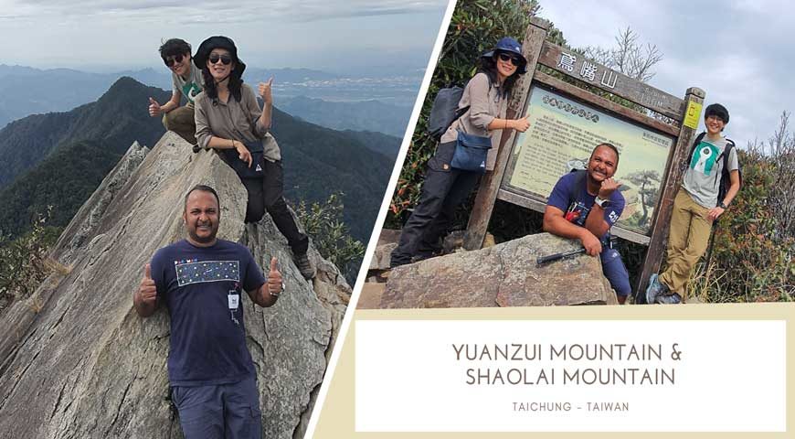
We planned a day trip with my local friends from Taichung Jo and Zoey. Zoey had been on this trail, but she had only done partial of the trail. We had planned to do a traverse through Yuanzui Mountain (2180m) and Shao Lai Mountain (2307m) and end our hike in Daxueshan National Forest Recreation Area carpark.
 Yuanzui Mountain: 2180m
Shao Lai Mountain: 2307m
Total Hiking Distance: 6-7KM approx.
Duration: 6-7 hours
Total Ascent: 663m
Total Descent: 468m
Yuanzui Mountain Difficulty Level: 8.5/10 – The starting part of the trail from the tunnel its pretty straight forward walk. After reaching the first shelter you will need to ascend some of the steep ridges, boulders. There are many safety ropes along but for people fear of heights it can be quite dangerous. Before to the summit also there are some steep section to traverse.
 Shao Lai Mountain Difficulty Level: 6/10 – After the summit of Yuanzui mountain you can descent using the alternate route. The first part of the decent is steep you will need to use the safety ropes. After that its more of a gradual walk to the peak of Shao Lai Mountain. Shaolai to Daxueshan has been developed from the mountain path used by the indigenous people and the forest patrol trail. The trail is on a smooth ridgeline and the view is unhindered.
Permits: Most of the mountain climbs in Taiwan need permits, this is to ensure the safety of all climbers. For Yuanzui mountain once can apply the permits on the spot at the Taichung City Police Bureau along the route to the trail start head. Once the hike is over do report them your descent also.
Address: Taichung City Police Bureau
台中市政府警察局和平分局大棟派出所
No. 2號, Xueshan Road, Heping District, Taichung City, Taiwan 424
Map: https://goo.gl/maps/2E1VD2JhSHXfpXc99
Transportation: Getting to the trail head is one of the most challenging part. You will probably need to drive up here to the trail head. There is very limited public transport available.
Driving by Car : National highway no.1 or no.3→take National Highway no.4 to the end→Turn left and transfer to Provincial highway no.3 to Tung shih→cross Tung-shih Bridge and go along Provincial Highway no.8→→take the intersection to Dasyueshan200 forest trail to the right of Shuan chi Station of Tung Shih Forestry Bureau on Tung Guan Rd., or enter through Fng Shi Rd. and turn left to Tung Keng Rd,→Dasyueshan200 forest trail →go through Heng-ling Shan Tunnel → The hiking trail entrance of Yuantsue-Shouklai section is at 27 + 50 kilometers; the hiking trail entrance of Xiao Xue Shan is at 35.2 kilometers.
Yuanzui Mountain Trailhead
424, Taiwan, Taichung City, Heping District, 200號林道
Map: https://goo.gl/maps/2r1ZJNVVgmmW1gfm7
By Public Transportation: Take Fengyuan Bus on Saturdays and Sundays (Provincial Highway -Big Snow Mountain)Provincial Highway Interval 08:00→Fengyuan Station 09:00→Tong Shih 09:30→Big Snow Mountain 11:00→Tian Chih Shenmu 13:00→Big Snow Mountain 14:30→Tong Shih Station 16:00→Fengyuan Station 16:30→Provincial Highway Interval 17:20(Provincial Highway Interval tel: 04-22877732; Fengyuan Station tel: 04-25246603)
Things need to be packed for this hike:
- Day pack (20-30L) (recommended Black Diamond Blitz 28, Fjallraven Kånken)
- Water (2L)
- Trail Food – Energy bars, ready to eat meals
- Stove/Gas (if you planning to enjoy some meals up the summit)
- Sunblock
- Leather Gloves (recommended Black Diamond Crag)
- Hiking shoes/Trail Running shoes (recommended SALOMON XA PRO 3D)
- Hiking Long Sleeve Tshirt
- Hiking Long Pants
- Hiking Poles
Weather: Before you plan this trip. Do check the weather forecast, do not hike this during the raining season it can be quite dangerous with slippery rocks. A bright sunny day is more suitable to enjoy the stunning views from the summit.
You can download the trail GPX here: https://drive.google.com/a/sgtrek.com/file/d/1MwIkGDT7eDmdPgndF2UNDck6mKIRRz1b/view usp=sharing
Around 8:00 am Jo and Zoey picked me up from my hotel at Taichung as they drove their car. Along the route we stopped by at 7-11 store to refill some food, trail snacks and water. 2liter water is enough for the hike. Incase if you are planning to cook some food recommend carrying more water. It took us around 1hours 30mins to reach the trail head with all the winding road. Do make sure to be early at this location most of the car is just parked along the road, so you may have less chance to park near to the entrance if you arrive late. Weekends are pretty packed up here. This place also is one of the hot spots to watch various kinds of birds, it’s a paradise for bird watchers. The most famous Formosan Blue Pheasant (藍腹鷴) can be found along the route if you are lucky enough.
 Upon parking the car, there is a basic toilet facility for you to use before the hike. There are many routes to climb up to the summit of Yuanzui Mountain, we choose the one closer to the tunnel end. A we were planning to do a traverse up to Shao Lai Mountain we tried to maximize the trail and hike most of the part.
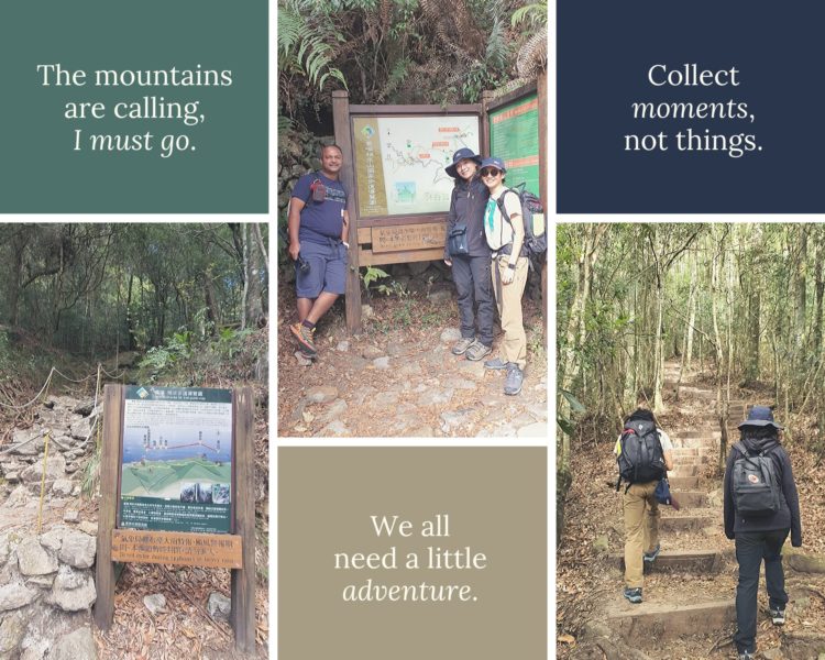
First part of the trail is well maintained with wooden stairs some parts. You would feel more like a tropical forest experience. Good point of starting the trail earlier is you could experience the magical sounds of various birds along the route. There are also couple of giant trees along the route. Some trees are backdated more than 100-150years old do enjoy your walk along in the nature. We took the walk slowly and managed to reach the first shelter around 50mins. We took a short water break, there were a lot of local climbers along some in big group.
 To avoid the huge crowded we quickly rushed back on the trail. The next part of the trail was complicated with lots of boulder climbing with some steep rock face. There is some safety rope placed along the climb which could make the climb much safer, but still hikers need to take extra care and safety while climbing this ridge line. Avoid going with a huge group as these sections take a lot of time to climb in big groups.
Finally, after an hour of climb we reached the peak of Yuanzui Mountain (2180m). The true summit of the peak a steep ridge line where most of the people love to take the stunning picture. Take extra care while climbing this ridge there are no safety ropes or barriers, can be risky during strong winds. This true peak makes a very good Instagram picture.
 Yuanzui Mountain became popular due to its peak stunning views, hikers could experience a breath taking 360degree views from the summit after a long scrambling walk. It’s worth every damn climb to reach this peak. After taking summit picture we planned to descent the other route to Shao Lai Mountain.
 Do take extra care while descending this route some section of the safety rope is worn out, the first part of this decent is very steep. After a while when you reach the junction the climb gets much easier. We stopped here for a lunch break.
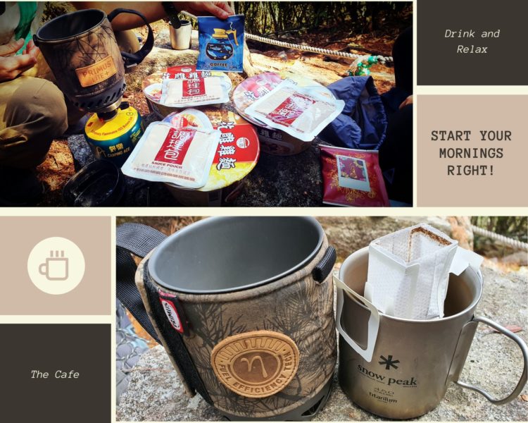 Jo and Zoey prepared some Taiwanese style instant noodle. Eating up on a mountain makes the food so delicious. We chilled out there for a while enjoying brewing some coffee. After a short break we started on the trail back to the summit of Shao Lai Mountain. There is no summit view from this location unless you climb the wooden observation deck. From there, one can see Anma Mountain and Chuanxing Mountain nearby and Yuanzui Mountain, Shaolai Mountain and Xiaoxue Mountain in the distance.
 The descent from the Shao Lai Mountain is very easy all the way down to the Daxueshan National Forest Recreation Area carpark. This trail is very well developed and maintained by the national park. Do take note upon reaching the carpark there is no transportation available back to the trail head of Yuanzui Mountain where we parked the car. So, we did hitch hike one of the rangers was very helpful to drop us back to our car location as he had just ended his day work and heading back to home.
Most of the Taiwanese people are friendly on the trial, they always offer food, water, if needed. Don’t forget to ask a lift back in their car, if not it’s along winding road about 5km+. Overall the hike is very enjoyable and all thanks for my friend Jo and Zoey to bring me on this great adventure.
SUBSCRIBE SGTREK YOUTUBE CHANNEL
Taiwan offers a lot of great hiking trail from day hikes to multiday hikes. Do check out this website for more information : https://recreation.forest.gov.tw/EN/Index
Do leave your comments below and follow our adventure page for more suck hikes.